
This content originally appeared on HackerNoon and was authored by oleksii_schastlyvyi
You’ve probably used a weather app. Maybe you’ve even built one. But do you actually know what a radar map is really telling you – or hiding from you?
As a developer and founder of Rain Viewer, I’ve spent the last decade parsing radar feeds, filtering out noise, and making chaotic atmospheric data digestible for humans – and APIs. If you’re building anything that touches geolocation, logistics, drones, or weather-dependent automation, understanding radar is more than curiosity – it’s the base.
Here’s your crash course in reading radar like a dev, not a tourist.
Radar ≠ Rain: Understand What You’re Seeing
First myth to bust: radar doesn’t “see” rain. \n It measures reflectivity (DBZH) – radio waves bouncing off something. That “something” could be:
- rain
- hail
- snow
- birds & insects
- dust or pollen
- even aluminum chaff from planes
Most apps simplify this into colored blobs. But that abstraction can hide a lot. Red doesn’t always mean danger, green doesn’t always mean a light shower.
How to tell what’s real:
Check RHOHV (correlation coefficient):
- 0.9? likely precipitation.
- <0.7? could be birds, bugs, or chaff.
Check VRAD (radial velocity):
- erratic jumps? probably biological.
Check ZDR (differential reflectivity):
- high ZDR? flat raindrops. near zero? hail or clutter.
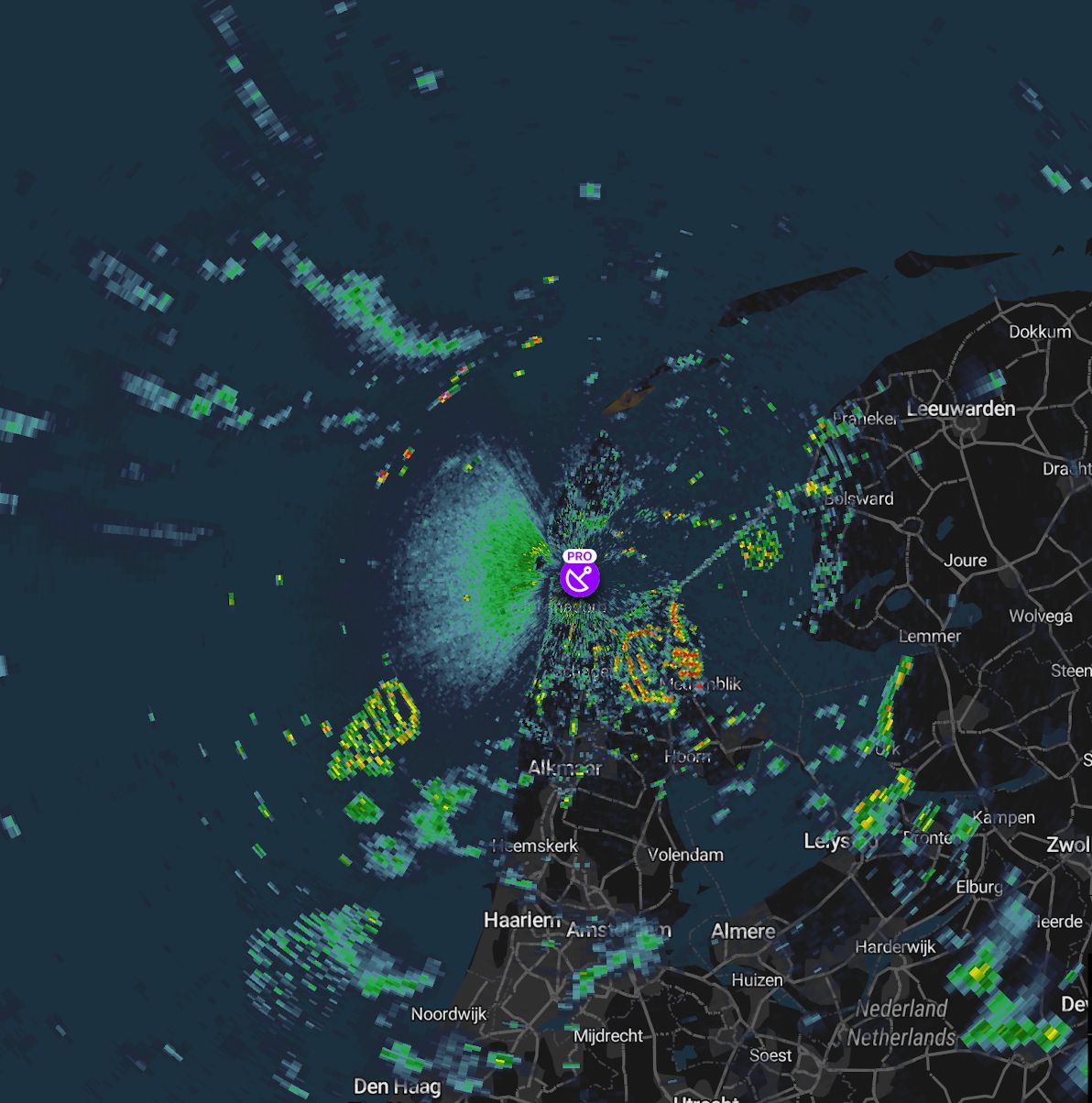
Example: if you see a blob with low RHOHV and chaotic VRAD, congratulations – you’ve spotted a swarm of birds.
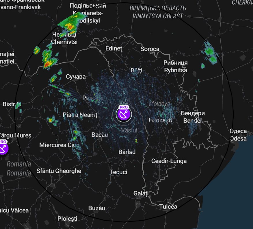
Radar Is Always Delayed
Radars don’t stream live video – they scan in rotation, upload in batches, then mosaic into frames. Expect 5–10 minutes of latency at best. \n For drones or real-time route optimization, factor this in – or you’re chasing ghosts.
Dev tip:
- Always read the metadata timestamps.
- Don’t combine frames from mismatched scans.
- Add a buffer window or fallback logic in latency-critical systems.
Motion Matters: Watch the Loop
A single frame is just a snapshot. But storms move fast. \n That cell 20km away, moving at 60 km/h, could be overhead in 20 minutes.
To build smarter UX:
- Animate loops with directional arrows.
- Compute storm vectors by comparing successive frames.
- Use interpolation between frames for smoother animations.
In Rain Viewer, we invested months optimizing storm tracking and arrow overlays – because pattern velocity beats position every time.
Signal ≠ Truth: Beware Artifacts
Radars don’t just pick up weather. \n Mountains, buildings, planes, wildlife, and temperature inversions all generate false echoes. Here are the common culprits – and how to catch them:
| Artifact | What it looks like | How to detect/filter | |----|----|----| | Ground Clutter | Persistent blob at low elevation | Static masks, Gabella filter | | Death Rings (AP) | Concentric rings expanding outward | Only at low elevation, disappears at higher scans | | Birds/Insects | Smudges that jump in VRAD | Low RHOHV + erratic velocity | | Chaff (military countermeasure) | “Snowflakes” in DBZH, no motion | Very low RHOHV | | Dust/Pollen | Weak streaks moving with wind | Low intensity & high correlation |
How to clean your data:
- Use multi-product checks (DBZH + RHOHV + VRAD + ZDR).
- Run Gabella filter (gradient + morphological analysis).
- Compare scans at different elevation angles.
Pro tip: The more products you combine, the better your noise filtering.
Where to Get Radar Data
If you want to experiment yourself, here are reliable open datasets:
- NOAA – US raw & MRMS (cleaned composite)
- EUMETNET OPERA – European composite
- opendata.fmi.fi – Finland
- opendata.dwd.de – Germany
- data.europa.eu – various EU datasets
Most raw data comes in HDF5, BUFR, or netCDF formats – so be ready to parse.
Why It Matters
Whether you’re building a delivery app, an autonomous drone, or just love hacking on weather data, radar literacy is crucial. You’ll stop treating those colorful blobs as gospel – and start seeing the patterns, pitfalls, and possibilities underneath.
Next time you look at a radar map, don’t just check if it’s raining. Read it.
\
This content originally appeared on HackerNoon and was authored by oleksii_schastlyvyi
oleksii_schastlyvyi | Sciencx (2025-07-12T01:00:16+00:00) How to Actually Read Weather Radar (Like a Developer). Retrieved from https://www.scien.cx/2025/07/12/how-to-actually-read-weather-radar-like-a-developer/
Please log in to upload a file.
There are no updates yet.
Click the Upload button above to add an update.